Turcja 2011
On September 7-14, 2011, the Polish Salt Mining Association organized the fourth scientific expedition under the slogan "evaporite deposits of Turkey - borates, sulfates, chlorides"
Expedition route:
Antalya, Salda Gölü, Pamukkale, Hierapolis, Iscehisar, Kirka, Beypazari, Çayirhan, Tuz Gölü, Kapadocja (Ürgüp), Konya, Tinaztepe (g.Taurus), Alanya, Antalya
1. Salda Gölü - alkaline salt lake
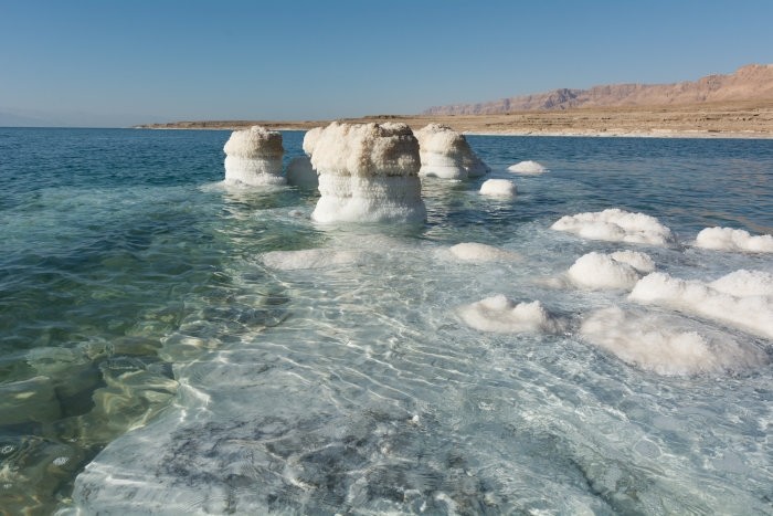
A closed lake lying in the N-depression of Mount Eseler in the Taurus tectonic range. One of the largest and deepest salt lakes. Remnant of a Pleistocene lake or lake system in central Anatolia. Highly alkaline waters - rich in sodium and magnesium. The lake is surrounded by hills forming a drainage basin made of ultrabasic and carbonate rocks.
- altitude: 1180 m above sea level area of 45 km2
- depth up to 104 m (180 - 200 m)
- alkaline lake: pH 8 – 10
- sodium and magnesium ions
- hydromagnesite
- hydromagnesite stromatolites
2. Pamukkale, Hierapolis - hot springs, travertine
Pamukkale - Cotton Castle owes its name to snow-white travertines, which have been formed here for at least 400,000 years, crystallizing from the waters flowing from hot springs. Growing travertines on the Pamukkale plateau partially covered the ancient city of Hierapolis. Pamukkale hydrothermal area - multilayer aquifers in the Paleozoic, Mesozoic and Pleistocene carbonate rocks, cut by faults, fed by rainwater and thermal waters.
3. Iscehisar - marble deposits
Marble from Western Anatolia deposits has been known in the world since ancient times. One of the deposit areas is Afyon-Iscehisar, which is one of the most important centers of marble production in Turkey. The marbles here are Paleozoic rocks, they occur in the roof of the complex called Afyon metamorphites.
4. Kirka - borate deposits
Borate deposits in Turkey occur in western Anatolia. Four deposits are being exploited. Kirka deposit - a deposit of Miocene lacustrine evaporites in the K?rka Basin is one of the largest deposits in the world. The main mineral of the deposit is borax (Na2B4O5(OH)4*8H2O), ulexite (NaCaB5O6 (OH)6*5H2O) and colemanite (CaB3O4 (OH)3*H2O) and many others. B2O3 content: 20 - 25%. Opencast mining.
The Kirk Basin is filled with a volcanic-sedimentary non-marine Miocene formation over 400 m thick. In its profile, the borate series reaches a thickness of 70 m, locally 145 m. Boron was probably supplied to the basin as a result of hydrothermal activity accompanying intense volcanism.
5. Çayirhan - deposit of sodium sulfate
Central Anatolia - Beypazari basin. Evaporites of the Kirmir Formation (Middle and Upper Miocene) were deposited in a shallow lake environment in the Late Miocene. Main minerals:
- glauberite Na2SO4 . CaSO4
- thenardite Na2SO4
- mirabilite Na2SO4 . 10H2O.
One of the deposits is Çayirhan. Mined in an underground mine by leaching in exploitation panels.
6. Tuz Gölü - Turkey's largest salt lake
The Konya Basin in the late Quaternary was covered by a vast lake; divided into subbasins. Lake Tuz Basin - Central Anatolia.
Lake Tuz: area 1600 km2
Depth: max 70 cm - 100 cm
Ions: Na, Ca, Mg, K, sulfate, chloride.
7. Cappadocia
Cappadocia lies in the collision zone of the Anatolian plate with the African plate; a number of active local fault zones - the main ones are the NE-SW and NW-SE zones; in these zones, large structures of young stratovolcanoes are developed:
Erciyes Dagi (3917 m above sea level) Hasan Dagi (3268 m above sea level).
Approx. 13 million years ago, in the eastern part of the Anatolian plate, the processes of lacustrine and river sedimentation began, translated by the deposition of products of volcanic activity. A vast plateau was formed, covered with a formation of vulcanogenic, lacustrine and river sediments with a layered structure and a total thickness of >400 m. Within the formation there are several separate covers of volcanic sediments: ignimbrites, tuffs and lava flows. Volcanic material was provided by stratovolcanoes (marked in morphology), catastrophic explosions and maar-type eruptions. Today's landscape of Cappadocia is the result of the destructive processes of erosion and weathering. These processes progressed in depth along vertical fracture systems (tectonics). Less resistant layers (less sintered pyroclastic formations and lake deposits) weathered and eroded faster under the influence of rain, wind and thermal changes. As a result, picturesque rock formations were created - ravines, canyons, roosts, chimneys, towers and mushrooms topped with hats of more resistant rock (basalt lavas, silkcretes and calcretes).


